" Theory is when you know everything and nothing works ;
practice, when everything works and nobody knows why. "
-Anonymous
ANGOSTURA BRIDGE (PART 2)
Hello and Welcome, as always SOMETHING NEW IN TOURISM.
remember that last week brief talk on the history of our Angostura Bridge, essential data, cost and a preamble to the location.
As mentioned above, were taken at three sites where you take out the bridge construction, these sites are: STONE MIDDLE ISLAND OF THE DEGREDO and between PUNTA and CHACON PLAYA BLANCA . Now, why we chose the latter and not the previous two?
The idea of \u200b\u200bbuilding it in MIDDLE STONE was rejected for reasons urban. If built there, would have relocated much of the population of Ciudad Bolivar and the problem of motor traffic would have been catastrophic.
For the type of bridge that was it, would be built on the outskirts of the city, as this is purely highway bridge. In addition, the historical aesthetics of the city had been disfigured beyond repair.
build in THE ISLAND OF THE DEGREDO , its cost would have been much higher, as would have been double its total length, in addition to ruin an island that has its place in history and had Angostura created Additionally, traffic problems and the relocation of the population of the city. Therefore, the most viable option was the third, the site is between PUNTA CHACÓN in Bolivar and Playa Blanca in Anzoátegui state.
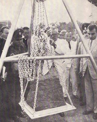
Foundation Stone laid by Venezuela's President Rómulo
The reasons why they decided to build on this site, the report Technical reflected in the book ( ANGOSTURA BRIDGE ON THE RIVER ORINOCO, Ministry of Public Works. Caracas, 1967 ) are:
"a) Although the length of the bridge is nearly equal to Site Middle Stone, no relocation of population problems and expropriation.
b) The cost of the bridge on this site is about half of what would have cost in the Degredo, due to their shorter length.
c) In the current site there are no problems of expropriation, which would not have happened in the other.
d) As the river bed is rocky on this site is ideal for melting.
e) The construction of the bridge in Punta Chacón allow the development the city westward, pursuing a new area "
We have said that the Angostura Bridge road and is clearly mixed type because it is part of a road system important because the main part of this structure is part pendant and access sections of prestressed concrete. The total width of the bridge is 16.60 meters, divided into four trails 3.65 meters, and two sidewalks of 1.0 meters each.
During the years 1963 and 1964, after the official start of construction work, we proceeded to study the basement where the batteries would be placed. The CANADIAN FIRM HUNTING SURVEY CORPORATION LTD., Conducted a preliminary study based on Hidrosonda, which showed as a result, the existence of a deep pit in steep walls that begins in Punta Chacón. Because it was decided to place the stack N º 8 in what we call Chacon peninsula (see Figure Geological Survey for the Foundations) to avoid deeper base due to the inclination that we mentioned.
 Geological Survey Scheme for Foundations.
(Graphic: Angostura Bridge over the Orinoco River. Caracas, 1967)
The main material of all the foundations of the South (Bolívar) is the granite rock, in the foundations of the north side (Anzoátegui) predominates Sienite DARK GRAY. (see concepts below)
Granite: deep rock best known and most widespread. Consists mainly of quartz, feldspar and mica and hornblende, augite, tourmaline, zircon, magnetite, etc.. Components, arranged without any direction and usually of equal size, are crystalline and fine to coarse grain. As the major components are distinguished Granite biotite Granite Granite Micaceous and amphibole. There are red granite, blue, gray, etc. (Dictionaries Rioduero, GEOLOGY AND MINERALOGY, 1985).
Sienite: Deep Rock similar to granite; is grayish-white or reddish gray, plutonic, low in quartz and feldspar composed of red and amphibole, biotite or pyroxene . Is less widespread than granite. (Dictionaries Rioduero, GEOLOGY AND MINERALOGY, 1985).
Other materials underneath (underground) of the structure the bridge are: Soft Clay loam, sandy clay Tiesas Mostly, hard black biotite schists, massive rocks, including granite and syenites Gris Pink Dark Grey, loose sand Fine to coarse filling the riverbed, Peñones Layer Fill in bed Rio (See definitions in technical and scientific concepts, higher or visit elblogdelgeologo.blogspot.com )
There are many technical issues to talk about our neglected and marginalized bridge, but  will touch here only the highlights of the topic as TOWER BRIDGE are structural steel section and the type of cell. Each is 119.175 meters in height, measured from its base and 140.585 meters height measured from the zero level of river.
is a tribute to give due recognition to the designer and driver of this impressive piece of engineering of our Guyana: illustrious son of this land, once ANGOSTURA, ENGINEER PAUL LUSTGARTEN.
is quite unfortunate that many of those who live here do not know who the strongholds that hold the culture, history and progress of our region, our city.
Timing of last section to finish up construction of the tower. (Photo: Angostura Bridge over the Orinoco River . Caracas, 1967 )
SOMETHING NEW TOURISM intrinsic aims to bring every one of you, valued readers, tools reflected in historical documentation, scientific, tourist and lore to heighten our gentile, recover lost values \u200b\u200band let the world know that Ciudad Bolivar, Venezuela has a voice and has much to tell.

Detail of one of the access section of the bridge during
construction. (Photo: Angostura Bridge On the Orinoco River . Caracas, 1967 )
0 comments:
Post a Comment